
The Condoto REDD+ Project, led by the Consejo Comunitario Mayor de Condoto-Iró, protects more than 65,452 hectares of forest in Condoto (Chocó) and has verified over 441,326 tons of CO₂ under the VERRA standard (VCS & CCB). It started on January 8, 2019, has a duration of 30 years, and is currently under implementation.
Who drives it?
The project is carried out with the active participation of local communities and organizations in Condoto, including COCOMACOIRO, its REDD+ Committee, and technical allies. The priority is collective decision-making, territorial planning, and transparency through bimonthly reports, activity records, and resource-use monitoring.
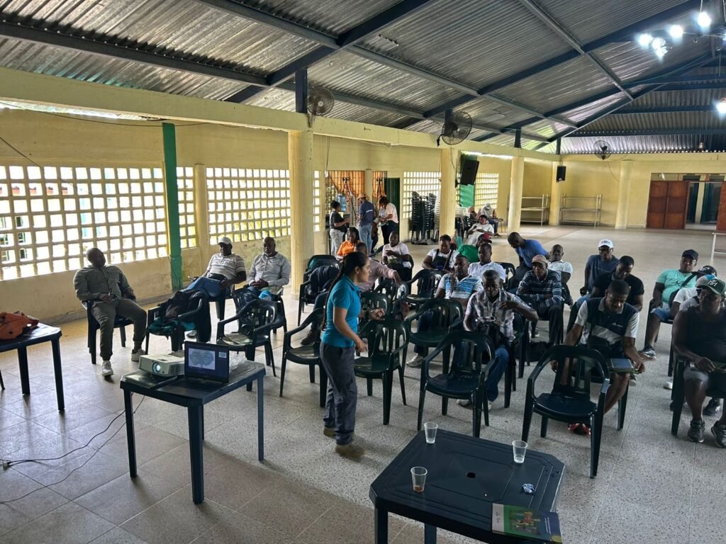
Integrated Farm and Agroecological Training
At COCOMACOIRO, an integrated and agroecological farm operates as both a classroom and a productive showcase. Acta No. 001 (May 7–9, 2024) detailed agricultural and productive strengthening through Good Agricultural and Livestock Practices (BPA/BPP), focused on food security, safety, and environmental sustainability.
The workshops addressed soil formation and water-related land management, soil biodiversity and living systems in agricultural production, the integrated use of resources and by-products (solid compost from agricultural and livestock residues), food sovereignty, traceability and food safety, introduction to soil, plant, and animal nutrition, and formulation of small diets using plant protein. A theoretical-visual workshop on local snakes covered ecological importance and accident prevention.
The farm enables food production, the recovery of ancestral knowledge, and reduced pressure on the forest.
Community Monitoring (MRV) and GIS
The project has a nine-month monitoring plan with approximately four monitoring sessions every two months, plus community workshops, including evaluation forms for facilitators and participants.
Report 1 – Training (August 2024): training in Geographic Information Systems (GIS) and mobile tools for monitoring deforestation and degradation (D&D), with hands-on practice in Avenza Maps, including installation, configuration, georeferencing, area measurement, route mapping, polygon creation, photo inclusion, and information sharing.
Zoning and Fieldwork: five monitoring points were defined using a systematic-random method in Condoto and Santa Rita de Río Iró, with field adjustments when points overlapped mining titles. Transects were prioritized and validated on-site. These activities established skills for area measurement, point collection, polygon tracing, and monitoring degradation processes.
During the fieldwork, opportunities for sustainable management were identified: maintaining ecological principles in management units for forest regeneration and climate resilience, multifunctional landscape use combining productive forestry, tourism, non-timber products, and research, and improving community well-being through conservation and sustainable resource use.
REDD+ Committee: Coordination and Governance
Between March and September 2024, governance activities included launching the REDD+ Committee and coordinating with the monitoring team, project dissemination, meetings with technical partners on commercialization reporting and operational costs, follow-up on commitments, issuance of approximately 1,000 ID cards (~45% of families), internal census updates, nutrition and sustainable food workshops, monitoring route planning, and defining areas for the first phase.
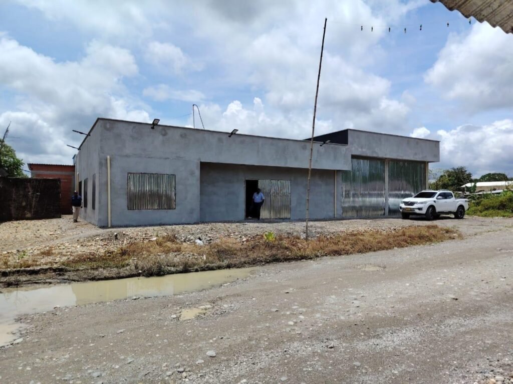
Coordination also included visits from biodiversity experts, including tracking jaguar footprints, and preparation for Phase 2 of the community house.
Education, Social Investment, and Infrastructure
The project supports education and well-being. In December 2023, it provided logistics and supplies for preschool, 5th, and 11th-grade graduations; an environmental innovation fair; sports and recreational kits; and improvements to school infrastructure and dining facilities.
Community House: Phase 1 (urban, architectural, and soil study designs) and Phase 2 (preparation of technical and social steps for construction).
Ethnodevelopment Plan: hiring a professional team and progress on a draft document.
Governance: internal regulations, self-census, ID cards, and coordinated territorial presence between the committee and monitors.
Upcoming Milestones
Complete the four-monitoring cycle, consolidate community MRV, advance the community house (Phase 2), and continue agroecological training at the farm. Condoto REDD+ demonstrates that conservation succeeds when the community decides, monitors, and produces in harmony with the forest.
The Community Forests supports and accompanies the Condoto REDD+ Project as part of its commitment to community conservation and territorial strengthening. Through technical and strategic support, The Community Forests helps local communities make informed decisions, implement sustainable practices, and develop monitoring and governance capacities, showing that environmental protection can go hand in hand with the well-being and autonomy of those living in the territory.
Photos: Cocomaicoro – Condoto Community – The Community Forests